The American City Metrics project is an in-progress interactive web atlas and system of metrics that uses open, commercial, informal, and emerging Internet of Things data sources to evaluate local places across time and location, assess urban form, and improve future development patterns.
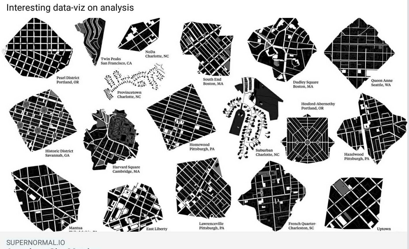
Supernormal builds tools to maintain agency in the design process and to accommodate our value system, which includes a focus on flexibility, replicability, and sensitivity to local cultural contexts. We recognize a clear need to take better advantage of growing urban data resources to create improved mechanisms for assessing not only walkability or physical development patterns, but also the life that these factors enable as places evolve and change over time. The atlas evaluates places based upon a set of design, real estate, and performance criteria. It combines map and chart-based data visualizations at the scale of a five-minute walkshed—the distance a person walks without a special destination in mind, which approximates the scale of human experience and local urban identity.
The walkshed is automatically calculated around any given geographic coordinate. Within a walkshed around a given point, we automate access to local data across a set of indicators to translate our urban value system into the American Cities index.
The end goal is a highly accessible web-based tool for finer-grained quantitative knowledge about the physical characteristics and qualitative performance or experience of a place. Showing change over the time spectrum of an average day, as well as trend-based analysis over months and years, is a priority.
Beginning with livability, access, and social opportunity as first principles, we look at qualities such resilience and community engagement. From these broad and generally qualitative values, we have established a set of urban criteria by which to translate high level values into urban space. For example, social access to “third places” is one good way to evaluate opportunities for community engagement.
We are generating walksheds across many locations to compare physical development patterns, and gauge their relative performance or effect of these patterns in terms of human experience and social function over time. We draw from open governmental data, commercial APIs and proprietary information sources. Data sources include OpenStreetMap, Factual, Google Places, Yelp, and Airbnb. We are collaborating within the Local Sense Lab to test out the opportunity for integrating local sensor and IoT (Internet of Things) data as well. We automate the walkshed creation so we can consistently measure urban form across neighborhoods. We also measure the life the urban form holds to create a bridge between our measuring and making, and to improve the feedback loop between design and its effect in the wild.
We are seeking funding and strategic partnerships to increase the speed of development and to merge the exceptional progress of urban tech with the communities and professionals that drive lasting local change.